Charleroi metro (officially called Métro Léger de Charleroi) It is a public transportation system of this city in Belgium.
This system, operated by TEC, was inaugurated on 21 June 1976. It has 2 lines, 48 stations and a length of 33 km (20,5 miles). The light rail connects the city center with its suburbs, facilitating the transportation of thousands of passengers daily.
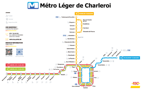
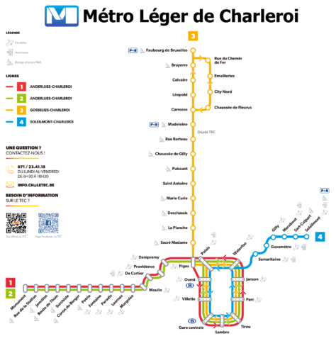
light rail map
Below we show you the Charleroi light rail map in two different versions. Click on the image to see it larger:

And then the same map, but in another format:

Schedules
- Monday to Saturday: 5:00h a 23:30h
- Sundays and holidays: 7:00h a 23:30h
Charleroi light rail fares
Here is the table with the main ticket prices on the Charleroi light rail, in euros (EUR) and its equivalent in US dollars (USD):
| Type of ticket | Price in EUR | Price in USD |
|---|---|---|
| One-way ticket | 2.10 | 2.29 |
| daily ticket | 5.00 | 5.45 |
| Pass of 3 days | 8.00 | 8.72 |
| Horizon Ticket (90 minutes) | 3.20 | 3.49 |
| Horizon+ Ticket (90 minutes, the entire network) | 5.30 | 5.78 |
| Mobib card | 5.00 | 5.45 |
Special Cards and Discounts
- Card Mobib: A reloadable card that costs 5.00 EUR (5.45 USD) and allows you to load different types of tickets and passes.
- fertilizer 6 a 11 years: The children of between 6 y 11 years can obtain a free pass to travel on the metro and other TEC services.
- Discounts for large families and students: There are reduced rates for large families and students, offering cheaper trips.
- Tourist Card: For the tourists, there are daily and multi-day pass options, like the pass 3 days, that allow an unlimited number of trips within the validity period.
Official Web site
- Official site of the Charleroi light rail: TEC Charleroi.
History of the Charleroi light rail
The Charleroi light rail project began in the 1970s. 1960, with the aim of modernizing public transport in the city and its surroundings. An ambitious system of 52 km with 69 stations, intended to replace the old tram networks operated by the SNCV and the STIC. Construction began at the end of that decade, and the first section was inaugurated on 21 June 1976, between Charleroi-Sud and Villette.
During the decade of 1980, several additional sections were opened. In 1980, section was inaugurated Villette-Piges. Two years later, in 1982, extension completed Morgnies-Paradis. In 1983, station Beaux-Arts and the section Piges-Dampremy were put into service. In 1986, the station was completed Pétria and the works in the east towards Montignies-sur-Sambre y Centenaire, although some sections remained unused.
The regionalization of Belgium in the years 80 reduced the funds available for the project, leading to the suspension of several planned extensions. Station Centenaire, finished but never used, is an example of these “great useless jobs”. Despite the difficulties, in 1992 section completed Dampremy-Morgnies and Gilly's antenna. In 1996, the stations were inaugurated Parc y Janson, almost completing the central loop.
The project was revitalized from 2008, with the resumption of works. In 2013, extension to Gosselies, adding 18 tram stations. This expansion marked the last major addition to the system to date.
In 2021, a recovery plan was approved that includes the extension of the metro to the new Grand Hospital of Charleroi (GHdC) a Gilly, with the construction of the future M5 line, scheduled to be completed in 2027.
Charleroi Light Rail Map History
In the years 70, when the construction of the light rail was planned and began, the first schematic maps were drawn up. These initial maps were created by engineers and designers working for the Société Nationale des Chemins de fer Vicinaux (SNCV) and the Société des Transports Intercommunaux de Charleroi (STIC). In this stage, the main focus was on clarity and functionality, ensuring that passengers could easily understand routes and connections.
During the decades of 1980 y 1990, The map design was influenced by expansions and changes to the system. In 1983, with the inauguration of new stations such as Beaux-Arts y Piges, The map has been updated to reflect these additions.. Local graphic design companies, in collaboration with transportation engineers, They adapted the map to include these new sections while maintaining visual simplicity..
The most significant transformation occurred in 2012 y 2013, when new lines and stations were completed and opened. The TEC (Transports en Commun), the company that currently operates the subway, hired designers specialized in infographics to modernize the map. This redesign included the incorporation of distinctive colors for each line and a more contemporary style that made navigation easier for users..
Charleroi light rail: Is it really a meter?
Charleroi light rail classification sparks debate. Some see it as a real subway due to its underground sections and dedicated tracks. These elements allow faster and more efficient transportation than a conventional tram..
However, others argue that it is not a true meter. They point out that it shares space with traffic in some areas and has a lower capacity and frequency than traditional metro systems.. This affects your speed and efficiency.
Public perception also influences. Many residents consider it to be more of an advanced tram than a subway, given its partial integration with traffic.
In conclusion, The controversy lies in its hybrid characteristics, that position it between a tram and a classic metro. This ambiguity in its design and operation fuels the debate about its true classification..
Additional data
The light rail has a maximum speed of 65 km/h and uses two-way vehicles supplied by La Brugeoise et Nivelles. Charleroi, known for its industry and culture, It also has important rail and bus connections at the station Charleroi-Sud. This station is a central node that connects with several train and bus lines, facilitating access to the airport and other Belgian cities.
- Musée de la Photographie (Stop: Sud, M4 line): The largest photography museum in Europe, with impressive and permanent exhibitions.
- BPS22 (Stop: Beaux-Arts, M1 line): Contemporary art center in an iconic industrial building.
- Rive Gauche (Stop: Charleroi-South, M1 line): A modern shopping center with shops, restaurants and entertainment.
- Rue de la Montagne (Stop: Parc, M4 line): Pedestrian street with boutiques, cafes and lively shopping life.
- Le Bois du Cazier (Stop: Mars, M1 line): Industrial and mining museum in a UNESCO-recognized historic site.
- Château Mondron (Stop: Waterloo, M3 line): Neoclassical castle surrounded by picturesque gardens.
- Abbaye d’Aulne (Stop: Junction, M2 line): Ruins of a Cistercian abbey in a serene natural setting.
- Street Art en Charleroi (Stop: Took out, M2 line): Urban art trail showcasing impressive murals and works by local artists.
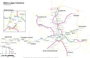
Old Charleroi light rail maps
These are old maps from previous years, that we leave them here in a historical way. To enlarge the images, you have to click above.


