Cairo metro, officially known as “مترو أنفاق القاهرة” (Metro Anfak al-Qahira), was inaugurated in 1987, being the first in Africa.
It has three lines that cover 77 kilometres (48 miles) y 61 stations. Connect Helwan in the south with New El-Marg in the north, relieving surface traffic. New lines are planned to expand its reach.
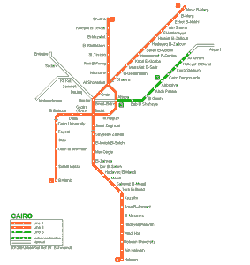
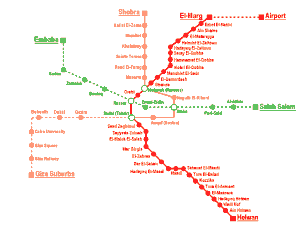
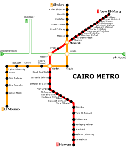
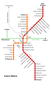
subway map
Below we show you the Cairo metro map. Click on the map to see it larger:
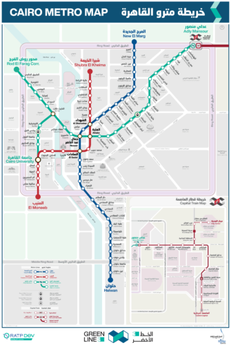
You can download the Cairo metro map in PDF format at mobilitycairo.com.
Schedules
The metro operates every day with the following schedule:
- Monday to thursday: 5:00 AM – 12:00 AM
- Fridays and Saturdays: 5:00 AM – 1:00 AM
- Sunday: 5:00 AM – 12:00 AM
Cairo Metro Fares
The Cairo metro is known for being one of the cheapest transportation systems in the world. Next, A table is presented with the main rates in Egyptian pounds (EGP) and its equivalent in US dollars (USD) so that tourists have a better idea of the price:
| Section of Stations | Precio (EGP) | Precio (USD) |
|---|---|---|
| 1 – 9 stations | 5 EGP | about 0.16 USD |
| 10 – 16 stations | 7 EGP | about 0.22 USD |
| 17 or more stations | 10 EGP | about 0.32 USD |
Special cards and discounts
The metro offers several card options and discounts for different types of users:
- Monthly subscription card: Available for frequent users, providing unlimited rides within the validity period for a reduced price.
- Student card: Offers discounted rates for students, facilitating your daily transportation at more affordable prices.
- Card for people with disabilities: Provides reduced rates for people with disabilities, ensuring more economical access to the transportation system.
- Tourist Card: Although it is not very common, There are daily or weekly passes that allow tourists to move more freely and at a lower cost during their stay in the city..
Official Web site
- For more information, visit the official website of Cairo Metro: www.cairometro.gov.eg
- For those who plan to spend several days in the city and want explore new things in Cairo, this website It is an excellent option, to get ideas or if something interests you, to buy advance tickets to any site.
History of the Cairo Metro
The history of the Cairo metro began in the years 70, when it was decided to alleviate traffic congestion in the capital.
The first line, Line 1, was inaugurated on 27 September 1987. This initial section, of 29 kilometres, connected Helwan in the south with El Marg in the north. Designed in collaboration with French engineers, the line 1 It was built by the French company RATP Dev and the Japanese Mitsubishi Heavy Industries. In 1999, This line extended to 44.3 current kilometers, serving 35 stations in total.
The second line, Line 2, started operating in 1996. This line, of 21.6 kilometres, She was a pioneer by being the first to cross the Nile River underground. Developed with technology Alcatel, expanded until it reached 20 stations in 2005. The line 2 includes underground and elevated sections.
The most recent development is the Line 3, whose construction began in 2006. The first phase, inaugurated in 2012, connected “Attaba” con “Abbassia“, then extending to “Heliopolis” in 2014. With plans to arrive at Cairo International Airport, This line promises a total length of 50 kilometres. Companies like Orascom Construction y Vinci have played crucial roles in its development. In 2019, phase 4A opened, and in 2022, phase 3A arrived at the metro station “Kit Kat“, with further expansions planned until 2024.
The last Cairo metro station to open is “Kit Kat“, part of the line 3. This station opened to the public in October 2022
Cairo Metro Map History
In the years 80, when the first metro line was inaugurated, The map was designed by Egyptian engineers and urban planners with the collaboration of the French company RATP Dev, known for its expertise in public transportation systems. These first maps focused on showing the main connections of the Line 1, what was about Helwan a El Marg.
Innovations and updates
As the subway system expanded with the opening of the Line 2 in 1996 and the line 3 in 2012, the map needed significant updates. The French company Thales, along with the Egyptian Orascom Construction, was in charge of these expansions and the modernization of subway signage and maps. These updates included the addition of new stations and lines, as well as the improvement in the clarity and readability of the map.
Modern technology and design
With technological advancement, the subway map also adopted digital elements. In 2019, interactive maps were introduced at stations, designed by the German company Siemens Mobility, allowing passengers to plan their routes more efficiently. Besides, These digital maps are accessible through mobile applications, facilitating access to real-time information on schedules and connections.
International contributions
The graphic design of the Cairo metro map has had the collaboration of several international designers. For example, the current map layout, which is used in both printed and digital formats, was developed by a team of Egyptian and French designers in 2020. We have the information (not confirmed) that the team was led by the graphic designer Jean-Michel Fischer.
Currently
Cairo metro map is updated by RATP Dev Mobility Cairo, a company that has been managing the system since 2021. This company is responsible for the operation and maintenance of the metro, as well as updates and distribution of system maps.
The National Authority for Tunnels (NAT) It also plays a crucial role in the overall supervision of the metro, including the planning and execution of new expansions and improvements on existing lines.
Additional data
Most of Cairo's most famous sites are easily accessible by traveling with the metro:
- Pyramids of Giza (Giza Station, Line 2): The iconic pyramids, one of the Seven Wonders of the Ancient World.
- Egyptian Museum (Sadat Station, Line 1 y 2): It houses a vast collection of pharaonic antiquities, including Tutankhamun's treasure.
- Saladin Citadel (Salah Salem Station, Line 1): Medieval fortress with panoramic views of the city and the Alabaster Mosque.
- Khan el-Khalili (Al-Azhar Station, Line 3): Historic market full of souvenir shops, jewelry and spices.
- Muhammad Ali Mosque (Salah Salem Station, Line 1): Also known as Alabaster Mosque, It is located within the Citadel of Saladin.
- Hanging Church (Mar Girgis Station, Line 1): One of the oldest churches in Egypt, located in the Coptic Quarter.
- Al-Azhar Park (Bab El-Shaaria Station, Line 3): Peaceful oasis with gardens, restaurants and impressive views of the Citadel.
- Mosque of Ibn Tulun (Sayyida Zeinab Station, Line 1): The oldest mosque in Cairo, famous for its unique minaret.
Old Cairo metro map
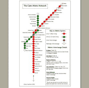
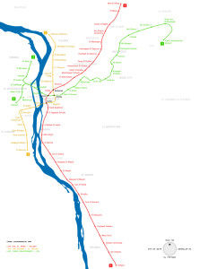
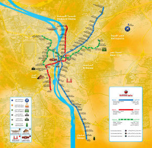
In a historical way we will post the old maps in this section, At the moment we have the maps of the year 2014:

