The metro de Mülheim an der Ruhr, locally known as “Stadtbahn Mülheim“, It is part of the public transport network of the Ruhr region, in Germany.
This system connects mainly with the city of Essen through line U18., encompassing 27.5 km, of which 1.9 km are shared with tram lines.
The Mülheim metro serves a population of approximately 170,000 inhabitants and is fully integrated with other means of transportation, such as buses and the S-Bahn network, connecting Mülheim with other cities in the Ruhr metropolitan area.
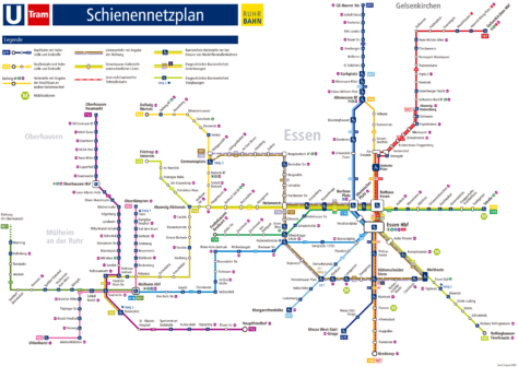
subway map
Here's the Mülheim metro map, click on the image to see it larger:

Schedules
The Mülheim metro is available to citizens and visitors according to the following schedule:
- Every day of 5:00hr until midnight.
Rates
Rates are unified with the VRR system, We also put the equivalent of dollars so that tourists get a better idea of the price:
- One-way ticket:
- Up to three stations: €1.60 ($1.90 USD)
- Zone A: €2.70 ($3.23 USD)
- Zone B: €5.80 ($6.95 USD)
- Zone C: €12.10 ($14.49 USD)
- Zone D: €15.00 ($17.96 USD)
Tickets for children (6-14 years) They always cost €1.60 ($1.90 USD)
Official Web site
For more information, Ask the official website of the Mülheim metro.
History of the subway
The history of the Mülheim metro, integral part of the Stadtbahn Rhein-Ruhr, started in the years 1970. The first plans sought to create a network of 300 km that would progressively replace the existing tram system. The intention was to alleviate the high unemployment rate among coal miners due to the collapse of the industry..
In 1974, the first sections were inaugurated in Duisburg and Essen. The first section of line U18, which connects Essen with Mülheim, was opened 1 June 1977, from Wiener Platz (hoy Hirschlandplatz) until Heißen Kirche en Mülheim. This line was one of the first to be converted and served as a model for future expansions..
The 3 November 1979, the U18 line was extended to Mülheim Hauptbahnhof. And with this expansion, the tram service on that specific route ended.. In the following years, connections were improved and more deeply integrated into urban infrastructure.
Changes and Adaptations
During the years 80, Various adjustments and expansions were made. In 1980, the tram network and Stadtbahn of Mülheim joined the Verkehrsverbund Rhein-Ruhr (VRR), facilitating a tariff and operational unification throughout the Ruhr region. This allowed passengers to use a single travel ticket., for different types of transport.
Recent Innovations
Despite financial and maintenance challenges, Mülheim continued to adapt its network. Recently, some tram sections were closed or converted to improve efficiency. However, Line U18 continues to be a fundamental pillar of transport in Mülheim.
History of the Mülheim metro map
The first Mülheim metro maps began to be designed in the years 70 by the engineers of the Verkehrsverbund Rhein-Ruhr company (VRR). These maps were created specifically for line U18. The network was officially launched in 1974, connecting stations between Duisburg and Essen. The first section of line U18, between Essen and Mülheim, was opened 1 June 1977.
In 1979, The metro map was modified as line U18 was extended to Mülheim Hauptbahnhof, marking the end of tram service on that route. This expansion consolidated the U18 as a pillar of urban transportation in the region. Since then, The line has been crucial in connecting Mülheim with other Ruhr cities..
Currently, the creation and updating of maps involves several designers and companies.. VRR engineers and the company Ruhrbahn GmbH have been key in this process. Ruhrbahn has maintained and updated the maps to reflect current expansions and improvements to the subway system.
Additional data
Mülheim is a city with a rich history and a strategic location in the Ruhr. It does not have its own airport, but it is well connected to Düsseldorf airports, Dortmund and Weeze via the S-Bahn network. Besides, the city is home to two institutes Max Planck, which underlines its importance in research and development.
The Mülheim metro connects several tourist and cultural points of interest in the city, facilitating access to some of the most famous places in the city. Some examples include:
- Schloß Broich: One of the oldest castles in the Ruhr region, located near Mülheim Stadtmitte station. This castle dates back to the Carolingian era and is an important point of interest for history and architecture buffs.
- Mülheim Hauptfriedhof: A cemetery notable for its design and historical value, accessible from Mülheim Hauptfriedhof station.
- Rhein-Ruhr Zentrum: A large and popular shopping center, ideal for shopping and entertainment, located near the station of the same name.
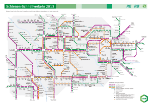
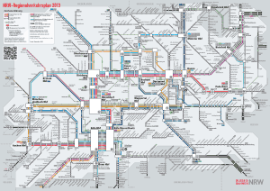
Old subway maps
In historical mode, We will be hanging the old Mülheim metro maps, at the moment we have those of the 2014 and previous:


