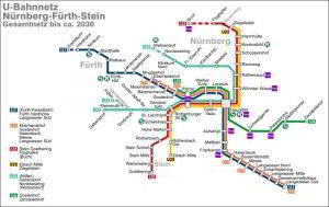
Nuremberg subway, officially known as “Nürnberger U-Bahn”, is the underground transportation system that connects the city of Nuremberg, Germany. It was inaugurated on 1 March 1972 and has continued to expand until its last extension in 2021.
The system has 3 lines, 49 stations, and covers 38.2 kilometres (about 23.74 miles). It is essential for the mobility of residents and tourists exploring Nuremberg.
subway map
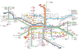
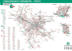
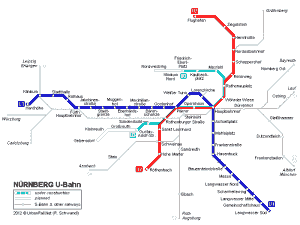
Here's the Nuremberg metro map along with its railway system. Click on the image to see it larger:
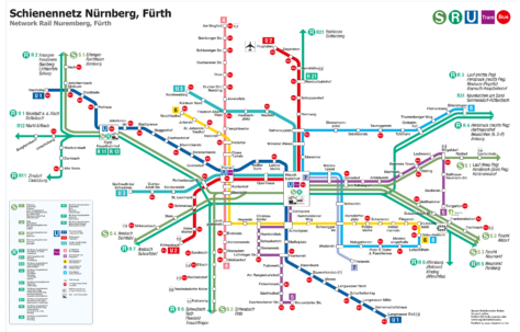
We also have the version in Nuremberg Subway Map PDF.
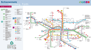
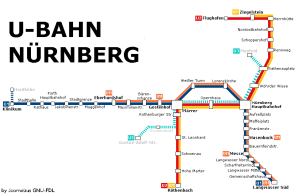
This is another version of the same map of the Nuremberg metro:
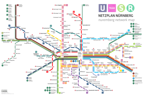
The second metro map we also have it in PDF format.
Schedules
The Nuremberg Metro operates with the following schedules:
- Weekdays and Saturdays: of 5:00h a 0:00h.
- Sundays and holidays: of 7:00h a 0:00h.
Rates
On the Nuremberg subway, Ticket prices vary depending on the type of ticket and the duration of the trip. Next, has a table with the main prices in euros and their approximate equivalent in US dollars, based on current rates.
| Type of ticket | Price in EUR | Price in USD (approx.) |
|---|---|---|
| One-way ticket (adult) | 3,70€ | $4.00 |
| One-way ticket (children) | 1,80€ | $1.95 |
| Short distance ticket | 2,00€ | $2.15 |
| Bill of 4 trips (adults) | 6,70€ | $7.25 |
| Daily ticket only | 9,70€ | $10.50 |
| Daily ticket plus (1-6 pers.) | 14,30€ | $15.50 |
| monthly card | 72,20€ | $78.00 |
For those who plan to spend several days in the city and want to explore, the Nürnberg Card It is an excellent option. For €33 (about $35.75 USD), offers free access to more than 30 museums and attractions, plus unlimited travel on public transport within zone A during 48 hours.
There are special group and event ticket options that provide reduced rates for cultural events and other discounts.. Besides, Reduced rates are available for students, and monthly and annual passes offer excellent long-term value for residents and frequent visitors.. For example, he Germany ticket, which is valid on all public transport in Germany, costs €49.00 per month (about $53.00 USD).
Official Web site
For more information, visit the official site of the Nuremberg metro.
History of the subway
Nuremberg subway, known as U-Bahn, It is a testament to technological development and meticulous urban planning, reflecting a long journey from its conception to the present.
The story begins in 1925, when Oscar Freytag proposed a subway system under Fürther Straße. Although it did not materialize at that time, interest in underground transportation persisted. During the Nazi regime, underground sections were built for trams, but they were not used for passenger services. The real spark for the construction of the U-Bahn arose after World War II, driven by the economic miracle and the growing motorization of the population.
In 1963, after several debates and studies, the Nuremberg city council approved the construction of a “Unterpflasterstraßenbahn” (underground tram). However, in 1965, the city decided to build a real subway. This decision was influenced by financial support from the federal government and the Bavarian state., which allowed construction to begin in 1967.
The first line, U1, was inaugurated in 1972, connecting the new district of Langwasser with the center and extending to Fürth. Expansion continued with the U2 line in 1984, which extended to the airport in 1999. In 2008, A significant innovation was introduced with the U3, Germany's first automatic metro line, which was also a pioneer in combining automatic and manual trains on the same track.
Since then, the system has continued to evolve, standing out for its efficiency and adaptation to the needs of a city in constant growth. Hoy, The Nuremberg U-Bahn is a critical component of the city's transportation infrastructure, gestionado por Verkehrs-Aktiengesellschaft Nürnberg (VAG) y formando parte integral del Verkehrsverbund Greater Nuremberg (VGN).
The most recent station to open on the Nuremberg metro network is the station Großreuth, that started working 15 October 2020. This station is located on line U3 and was the last terminus of said line until its opening..
History of the Nuremberg subway map
The Nuremberg metro map has evolved over the years, reflecting the expansion and modernization of the system.
Designers and planners like Ernst Henneberg, who was responsible for the first plans and layouts, They played a fundamental role in the creation of the first maps that guided passengers.
As more stations were added and lines extended, The map design was refined to include clearer and more legible outlines.. The inclusion of differentiated color systems for each line facilitated quick identification of routes.
More recently, The upgrade work has been supervised by the Nuremberg Transport Association (VGN), that continues to adapt design to the needs of modern travelers, integrating digital technology for real-time localization and offering digital versions online.
Additional data
The Nuremberg subway is not only an efficient means of getting around, but also connects directly with some of the most prominent tourist sites in the city.
For example, station Lorenzkirche brings visitors to the Gothic St. Lawrence Church and the Königstraße pedestrian zone. from the station Rathenauplatz, you can reach the Railway Museum, where Germany's rich railway history comes to life. To visit Nuremberg Zoo, travelers can get off at the station Zoo.
The Documentation Center, Located on the former Nazi Party congress grounds, It is easily accessible from the station Documentation Center. In addition to these points, The metro has been fundamental in promoting urban sustainability, since its use significantly reduces private vehicle traffic, thus contributing to a cleaner and more environmentally friendly city.
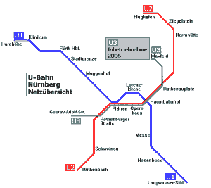
Old Nuremberg subway maps
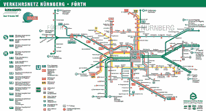
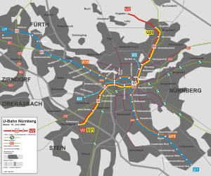
For historical purposes, we present here subway maps from before the year 2014:
